The Daily Tar Heel
Printing news. Raising hell. Since 1893.
Wednesday, April 17, 2024 Newsletters Latest print issue

We keep you informed.

Help us keep going. Donate Today.
The Daily Tar Heel

New state legislative maps head to N.C. superior court for approval

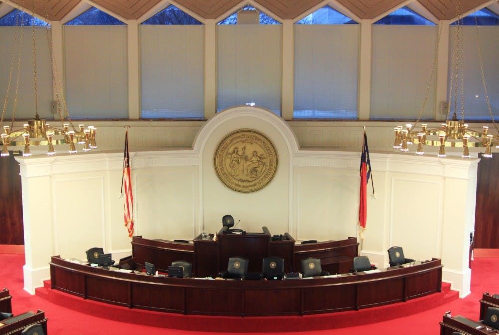
The North Carolina State Legislative building is located at 16 W. Jones St. in downtown Raleigh. The N.C. General Assembly went into a special session on Nov. 27. DTH File/Katie Sweeney

The North Carolina State Legislative building is located at 16 W. Jones St. in downtown Raleigh. The N.C. General Assembly went into a special session on Nov. 27. DTH File/Katie Sweeney

The General Assembly has finalized new legislative maps for both the N.C. Senate and N.C. House that now must be approved by a court.

The new maps were ordered to be redrawn after a three-judge panel of an N.C. Superior Court declared them unconstitutional on Sept. 3. 

The plaintiff in that court case, Common Cause North Carolina, released a statement following the vote on the maps.

“The court’s ruling against partisan gerrymandering was a historic victory for the people of North Carolina, setting a clear requirement for drawing districts completely free from partisan politics and with total transparency,” Brent Laurenz, Common Cause NC’s deputy director, said in the statement. “We look forward to the next steps in this ongoing remedial process, which includes the court thoroughly reviewing the new districts to ensure that they fully comply with the ruling.”

State representatives redrew the districts in public sessions. The superior court decision disallowed lawmakers from accessing the previous legislative maps during the redrawing process, and incumbents were not allowed input into redrawing their own districts. 

Despite these measures being put in place, N.C. Rep. Graig Meyer, D-District 50, who represents Orange and Caswell County, said he was still unsatisfied with the new maps.

“I still think that they are partisan, gerrymandered maps,” Meyer said. “I believe that the number one thing we learned from ten days of mapmaking is that you should never let legislators draw their own maps.”

Meyer said his objection to allowing legislators to draw maps was that incumbent protection was prioritized over fair elections. 

“I voted 'no' on the maps and still think the most important thing we can do for North Carolina democracy is to set up an independent and citizen-led redistricting process,” Meyer said.

Tomas Lopez, executive director of Democracy North Carolina, a nonpartisan research and advocacy group that works toward electoral fairness, also said despite the redistricting process being the “most open process we’ve had in North Carolina,” he still thought it wasn't good enough.

“Whether you’re skewing the lines in private or in public, you’re still skewing the lines,” Lopez said.

Lopez said allowing legislators to draw their own maps was problematic.

“Look, I think legislators worked hard here, and even still, there are these structural issues that stem from the people drawing the lines being the same people who will benefit or not benefit from them,” Lopez said.

The approved maps from the General Assembly will now be sent back to the original three-judge panel who will evaluate the maps along with an independent expert. They will have the ability to make changes to the proposed maps before they will be officially adopted.

Mitch Kokai, senior political analyst at the John Locke Foundation, said the original court order required changes to be made to N.C. House districts in 28 counties and N.C. Senate districts in 21 counties. Orange and Durham counties were not affected by the redrawn maps.

Kokai said barring any appeals from either side in the original court case, the map approved by the court will take effect in 2020. He said he thought the judges and expert are not likely to change the maps heavily due to bipartisan support for maps, particularly in the N.C. Senate, where the vote for the new maps was 38-9.

On the N.C. House map, Kokai said changes may be made to districts in Cumberland, Pender, Columbus and Robeson counties due to objections made during the redrawing process. 

The baseline map being used in the process was one of the 1,000 generated by the plaintiffs’ expert in the court case, Jowei Chen.

“In general, if Democrats still continue to have concerns about the redrawn maps, it’s not maps that were redrawn behind closed doors with partisan intent, it’s maps that were drawn in a public process using random selection of maps that the Democrats’ own expert put together,” Kokai said.

Kokai and Meyer said they both thought the new maps did not put the Republicans’ majority in either house in jeopardy.

city@dailytarheel.com

To get the day's news and headlines in your inbox each morning, sign up for our email newsletters.

Special Print Edition
The Daily Tar Heel's Collaborative Mental Health Edition


More in City & State

More in City & County

More in The OC Report