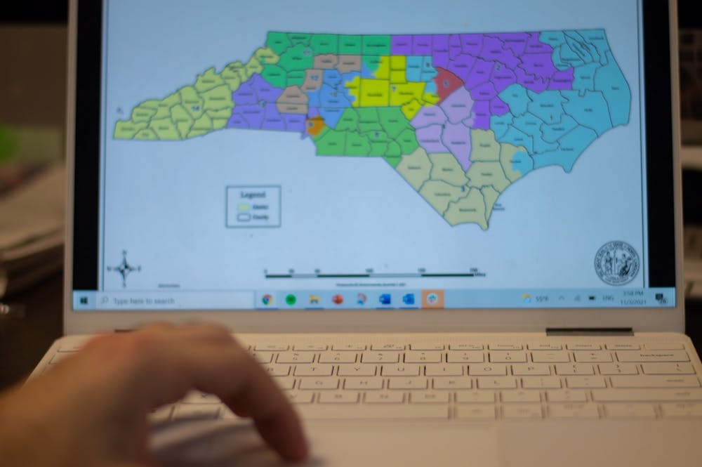
On Monday, a Republican-led redistricting committee in the N.C. Senate approved new congressional maps in North Carolina. The new maps will reshape the congressional districts in the U.S. House of Representatives, notably adding a new 14th congressional district in the House.
The new maps will go into effect for the 2022 election cycle. Based on election data, the new maps would likely lead to 10 Republicans and four Democrats elected to the House from North Carolina.
This ratio is contrary to North Carolina’s role as a purple state, where former Republican President Donald Trump won North Carolina by less than two points and Democratic Gov. Roy Cooper won by less than four points in the 2020 election cycle.
The proposed maps are labeled as an instance of “extreme gerrymandering” by state Democrats. They argue the congressional districts were drawn with partisan advantage in mind. The Princeton Gerrymandering Project, which uses statistical models to grade congressional redistricting processes, gave the new map a rating of "F."
State Democrats are questioning the Republican decision to split the Democratic-leaning Guilford, Mecklenburg and Wake counties into three different congressional districts, claiming the move was meant to give Republicans a partisan advantage in next year’s election cycle.
Representative Kathy Manning, a Democrat who represents the 6th district, which currently spans all of Guilford County and half of Forsyth county, voiced her displeasure of the new maps in an interview with Spectrum News.
"These congressional maps represent an extreme partisan gerrymander that splits communities of interest," Manning said. "Under these maps, Guilford County is split into three congressional districts, diluting my constituents' interests and lumping them in with far-flung counties in the western mountains, the suburbs of Charlotte and as far east as Wake County.”
Manning’s path to reelection now appears much more difficult with her district makeup shifting from an urban to a rural setting, placing her residence in the same district as seasoned GOP Rep. Virginia Foxx from Watauga County.
“It’s not coincident that it’s only in the urban areas that you subject these counties to that kind of treatment,” said Democratic Senate Minority Leader Dan Blue in front of the N.C. General Assembly. “This kind of radical extreme effort simply takes (legislators) out of the process."